The Irwin assessment area
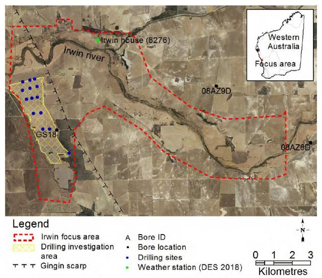
The Irwin focus area – about 7000 hectares – is located on fertile loam and clay flats associated with the Irwin River (Figure 1). In the east, it encompasses the Irwin River valley floor, and the western boundary loops to the south of the Irwin River to capture an area of alluvial clays. The Gingin Scarp forms a boundary between the east and west parts of the focus area.
What we did
We:
- used groundwater data from resource condition monitoring in the Arrowsmith Hydrozone to assess the hydrological hazards in the Irwin focus area and guide more-intensive field investigations
- drilled shallow bores to investigate the soil profile and to sample and monitor the watertable in the western part of the Irwin focus area
- established monitoring bores at 13 sites on the alluvial clay flats
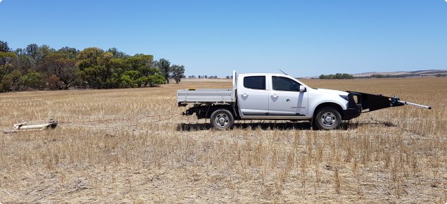
- complemented the shallow drilling program with ground-based electromagnetic (EM) surveys, using a vehicle-mounted system to record electrical conductivity measurements from Geonics™ EM38 and EM31 instruments.
What we found
In the eastern part of the focus area
We found that rising groundwater and salinity makes the eastern part of the focus area unsuitable for irrigated agriculture.
Historical groundwater level monitoring in the Irwin River valley indicates consistently rising groundwater levels east of the Gingin Scarp in the Arrowsmith Hydrozone. This trend and shallow depth to groundwater poses a significant risk of dryland salinity developing in this landscape.
In the western part of the focus area
We concluded that irrigation of the clay soils – that have high levels of salt stored at depth – would have an increased risk of a rising saline watertable that would make it unsuitable for agricultural production.
West of the Gingin Scarp, the soil profile under the alluvial flats that extend south of the Irwin River is dominated by stiff, moist, grey clay that becomes red-brown or mottled brown and pale grey clay with depth. While the surface soils are not salt-affected, there is significant salt storage at depth, starting from about 3m to about 7–10m. Since groundwater is not rising in this area the regolith salt storage is not a hazard for dryland agriculture. However, if irrigation water is applied and groundwater rises, it will become a significant hazard.
The hydraulic properties of the alluvial clays could not be closely observed during the investigation because of the absence of recharge because of low rainfall. However, the drill cuttings of heavy, moist clay indicate that there is low hydraulic conductivity or permeability. If the surface soils were to become saline from irrigation, they would likely remain saline because of the limited leachability of the clays.
Overall Irwin focus site assessment
Because of the risks associated with irrigation, the focus area is deemed not suitable for a 2000–3000 hectare irrigation precinct. Carefully selected smaller sites in the focus area that have good quality water and good management practices may be suitable for irrigation.
For further information
Download the full report 'Hydrological hazard assessment for irrigated agriculture in the Irwin focus area', Resource management technical report 407 (PDF 4.1MB).
Acknowledgements
The work was funded by the Western Australian Government, through the Royalties For Regions Water For Food program.


