Why we assessed soils of the Weaber Plain (Goomig) Farmlands
The Western Australian Government requested this department to lead a project supporting a second phase of modelling for the Weaber Plain (Goomig) farmlands.
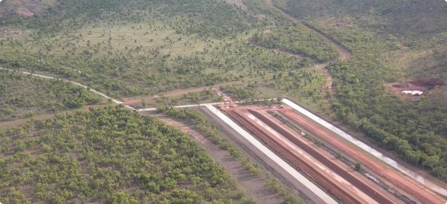
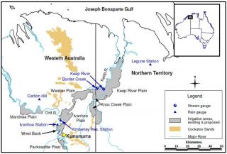
The state government approved the Ord Irrigation Expansion Project in 2008, to develop irrigated agriculture on the proposed 8000-hectare Weaber Plain (Goomig) farmlands, which is located north-east of the existing 14 000–hectare Ord River Irrigation Area (ORIA), 30 kilometres from Kununurra (see Figure 1).
The project began in 2009, with construction of a new irrigation water supply channel connecting the Weaber Plain to the existing ORIA – the final period of irrigation design – and environmental management and related approval processes.
As part of the environmental planning and approvals process, the state government was required to prepare a groundwater management plan and a hydrodynamic plan. These plans were to investigate potential risks of increasing salinity and changed water quality that could result from developing the proposed farmlands, and to specifically use new hazard mapping derived from SkyTEM airborne electromagnetics (AEM) data.
Previous studies identified that the existing groundwater data was inadequate for evaluating risk and quantifying the impact of options to manage shallow watertables and salinity; that soil and subsoil data was limited; and that downstream impacts required further evaluation.
What we did for the assessment
The project investigated 5 components: 2 on deficiencies related to groundwater, 2 relating to soils and subsoils, and 1 on surface and groundwater quality aspects.
This page and the report (Soil assessment of the Weaber Plain (Goomig) farmlands) summarises the 2 soil assessment components of the project.
This assessment:
- distinguished areas of Cununurra and Aquitaine clay
- collected baseline information on soil structure, potential soil salinity hazard, and soil drainage prior to agricultural development
- characterised the soil profile to a depth of 2–4 metres, including the substrate and the saturated hydraulic conductivity.
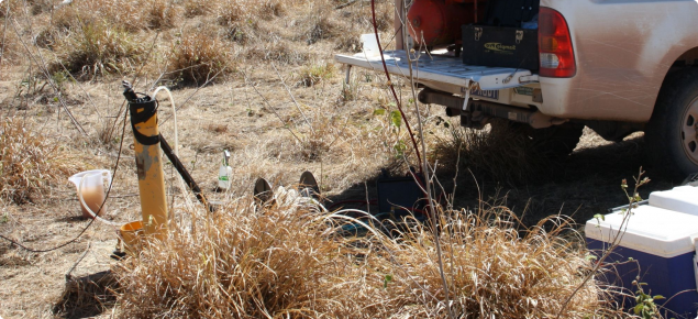
The soil profiles and substrates are described across the main soil, landform, geology and vegetation units determined from previous survey data and more-recent AEM mapping. One hundred and sixty backhoe pits were excavated along 12 transects to expose the substrate (C horizon) below the cracking clay horizon. The soil profile and morphology were characterised at each site and infiltration tests using a constant head permeameter were conducted within each map unit and for a range of soil texture classes within the substrate.
What we found
The use of existing soil–vegetation boundaries overlain with AEM mapping combined with the excavation of deep soil pits to the substrate was an efficient method of locating contrasting soils and substrates. The assessment found that:
- the AEM data is positively correlated to field electrical conductivity (EC) measurements and substrate clay content (EC readings are correlated with soil salt levels)
- soils with medium to heavy clay substrates are usually less well drained and have relatively high levels of boron, chloride, and exchangeable sodium percentage at 100 and 200 centimetre depth compared to soils with coarser-textured substrates
- in general, areas of typical Cununurra clay and friable self-mulching topsoils that have developed on coarse to medium textured substrates (sand to fine sandy clay loam) had relatively low inherent EC
- areas of Aquitaine clay that are subject to more run-on and frequent inundation have relatively high subsoil EC, and have formed on medium clay to medium-heavy clay substrates
- soil pit sampling helped locate and verify the position of a palaeodrainage system determined by AEM mapping and deep drilling
- saturated hydraulic conductivity tests carried out on soil substrate at 50 sites indicated that substrate permeability was generally higher in areas of Cununurra clay, particularly over the palaeodrainage system.
What this means
Areas dominated by Cununurra clay and by the less saline variants of Aquitaine clay have a moderate to high capability for horticultural development.
Areas containing the soil complexes, Cununurra/Aquitaine clay intergrades and the better drained areas of Aquitaine clay present moderate limitations to sustainable horticultural development that can be overcome with careful management.
Areas of Aquitaine clay generally have a low capability for horticultural development; however, they can be used for moderately salt-tolerant crops provided the groundwater is kept more than 2 metres below the soil surface.
For more information
Full details are in 'Soil assessment of the Weaber Plain (Goomig) farmlands' , Resource management technical report 369.


