Why investigate groundwater chemistry of the Weaber Plain?
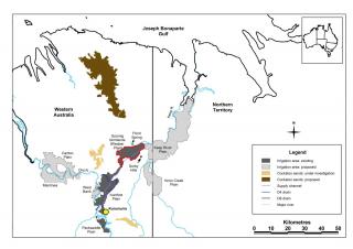
The Weaber Plain area is north-north-east of the existing (as at 2009) Ord River Irrigation Area (ORIA), and about 30 kilometres from Kununurra. This area was considered to be suitable for irrigation for many decades before this study started.
In June 2010, the Australian Government determined that the project had the potential to have a significant impact on Matters of National Environmental Significance, and therefore required the project to meet conditions as part of the environmental approvals issued under the Environmental Protection and Biodiversity Conservation Act 1999 (EPBC).
State and Australian government environmental approvals required the proponent to install a groundwater monitoring network and to develop a groundwater management plan. The approvals required seasonal monitoring of groundwater to establish baseline groundwater chemistry values.
The monitoring regime was to find whether groundwater posed a direct or indirect threat to environmental assets of the Keep River and if any risks to the farmland or the environment could be managed
Our assessment program
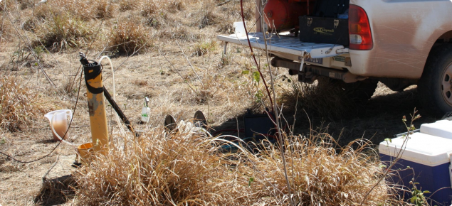
DAFWA established and monitored an extensive number of bores and arranged the relevant water chemistry analyses.
- We used 16 existing bores (drilled between 1964 and 1997 on the Weaber and Knox Creek plains).
- We drilled an additional 40 bores over the 2010 and 2011 dry seasons to supplement the existing bores.
- We established 20 bores with data loggers and 30 bores (2 of which were dry for the reporting period) without data loggers across the proposed farmland and buffer areas.
- We set up another 8 bores as long-term reference controls. Four of these had data loggers and 4 did not.
- We monitored and reviewed the water quality of groundwater over a 40-month baseline study period (2010–13) to assess the risk to environmental assets, such as the Keep River, and to underpin management options to mitigate any risks.
- We sampled all of the bores twice a year: at the end of the wet and dry seasons.
- We measured conductivity, temperature, acidity, oxygen, total alkalinity and total acidity in the field.
- We sent all groundwater samples to the ChemCentre WA where they were analysed to meet EPBC conditions and as set out in the groundwater management plan:
- major ions
- minor ions
- metals and metalloids
- nutrients
- general chemistry
- farm chemicals (atrazine).
What we found
Groundwater under the Weaber Plain poses a low and longer term environmental risk to the Keep River:
- The impact of agricultural development on groundwater on the Weaber Plain is likely to pose a relatively low risk that would take a considerable time (100 years) to affect the Keep River (the receiving environment).
- Expected risk from groundwater interactions with the agricultural soils has adequate technical and management controls to allow risks to be managed as part of routine procedures.
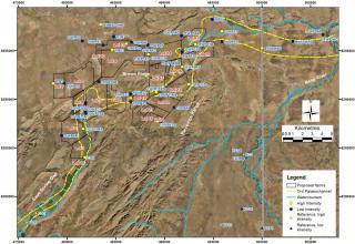
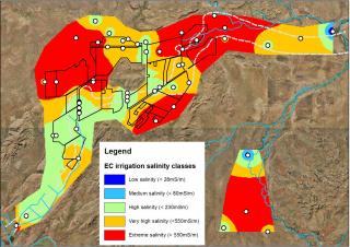
- Groundwater salinity is too high (more than 80 milliSiemens per metre) for the longer term direct irrigation of the proposed farmlands (see image below).
- Groundwater in parts of the area is naturally high in uranium, manganese, iron, boron, and fluoride and exceeds the long-term trigger values for these metals/metalloids.
- On the northern margins and east of the farmlands, groundwater is naturally high in zinc, copper, lead molybdenum and vanadium.
- Mixing groundwater with supply channel water to achieve acceptable salinity levels will also reduce metal and metalloid levels to allow conjunctive use of pumped groundwater for irrigation.
For more information
Download Resource management technical report 392 Groundwater chemistry of the Weaber Plain (Goomig Farmlands): baseline results 2010-13 or use the contact details below.

