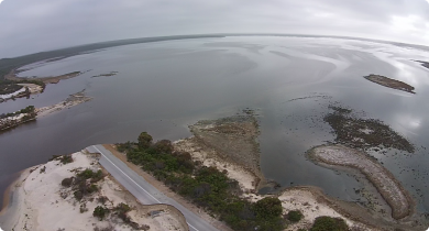
Climate & weather
Enabling farm businesses to better manage the increasing seasonal variability is critical for the success of the Western Australian agrifood sector. The Department of Primary Industries and Regional Development is enabling farm businesses to make more informed planning and financial decisions on weather and climate risks. These decisions range from short-term tactical decisions, through to managing strategic planning for climatic futures. The development of improved weather data and seasonal forecasting tools are designed to assist you to better manage and take full advantage of the opportunities related to seasonal variability and climate change.
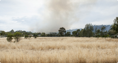
The Department of Fire and Emergency Services has launched a new website; emergency.wa.gov.au. This website will replace the existing alerts and warnings websites from DFES and Parks and Wildlife, enabling people to get critical public information during fire, flood, storm, earthquake, tsunami and emergencies involving hazardous materials.


Filter by search
Filter by topic
- Crops (54) Apply Crops filter
- Climate change (41) Apply Climate change filter
- Grains (39) Apply Grains filter
- Livestock & animals (28) Apply Livestock & animals filter
- Frost (24) Apply Frost filter
- Livestock management (16) Apply Livestock management filter
- Fire (15) Apply Fire filter
- Soils (12) Apply Soils filter
- Dry seasons and drought (12) Apply Dry seasons and drought filter
- Wheat (10) Apply Wheat filter
- Horticulture (10) Apply Horticulture filter
- Managing soils (8) Apply Managing soils filter
- Land use (7) Apply Land use filter
- Floods, storms and cyclones (7) Apply Floods, storms and cyclones filter
- Production & postharvest (6) Apply Production & postharvest filter
- Measuring and assessing soils (6) Apply Measuring and assessing soils filter
- Grains research & development (6) Apply Grains research & development filter
- Canola (6) Apply Canola filter
- Rangelands (5) Apply Rangelands filter
- Livestock species (5) Apply Livestock species filter
- Feeding & nutrition (5) Apply Feeding & nutrition filter
- Pastures (4) Apply Pastures filter
- Sheep (4) Apply Sheep filter
- Fruit (4) Apply Fruit filter
- Lupins (3) Apply Lupins filter
- Water (3) Apply Water filter
- Wine grapes (3) Apply Wine grapes filter
- Livestock research & development (3) Apply Livestock research & development filter
- Water management (3) Apply Water management filter
- Pulses (3) Apply Pulses filter
- Carbon farming (3) Apply Carbon farming filter
- Grapes & wine (3) Apply Grapes & wine filter
- Drought (3) Apply Drought filter
- Animal welfare (3) Apply Animal welfare filter
- Grains Research & Development (3) Apply Grains Research & Development filter
- Pests, weeds & diseases (2) Apply Pests, weeds & diseases filter
- Pasture management (2) Apply Pasture management filter
- Pome fruit (2) Apply Pome fruit filter
- Resource assessment (2) Apply Resource assessment filter
- Oats (2) Apply Oats filter
- Water erosion (2) Apply Water erosion filter
- Avocados (2) Apply Avocados filter
- Biosecurity & quarantine (2) Apply Biosecurity & quarantine filter
- Biosecurity (2) Apply Biosecurity filter
- Carbon Farming - related pages (2) Apply Carbon Farming - related pages filter
- Field peas (2) Apply Field peas filter
- Genetics & selection (2) Apply Genetics & selection filter
- Irrigated crops (2) Apply Irrigated crops filter