Rainfall update 4 July 2018
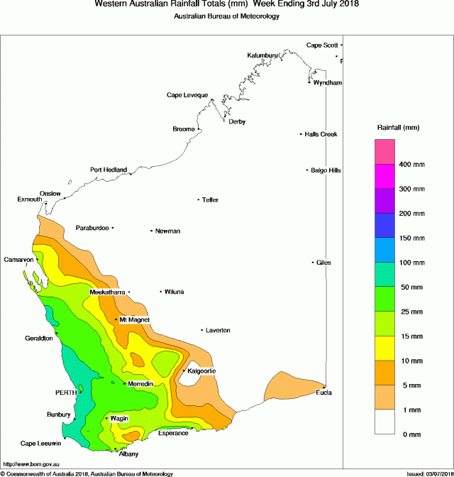
Rainfall over the past week has been good along the west coast from the south-west to Shark Bay and for much of the central grainbelt. While the south coast has picked up some useful falls, totals remain lower.
Rainfall totals in the past week
Rainfall for the month to date
The month has begun with good falls in the areas already indicated. The south coast and far north-east of the grainbelt have received mostly less than 10mm so far.
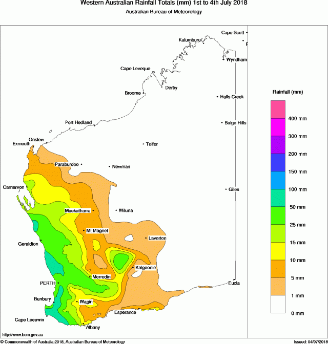
Monthly rain to date from DPIRD weather stations can be found at https://weather.agric.wa.gov.au/. Select Month to date from the drop-down menu.
Seasonal rainfall
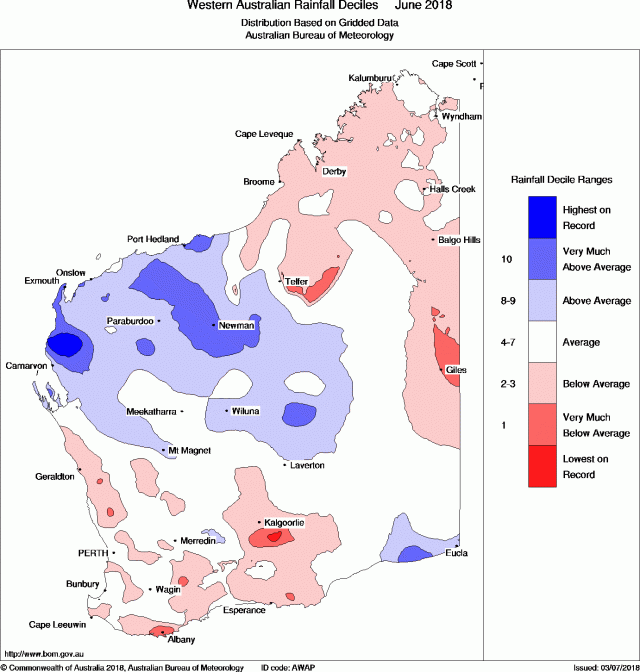
June rainfall was near-average or below for most of the grainbelt and south-west (Figure 3). Rain from cloudbands ensured the Gascoyne and Pilbara were well above average.
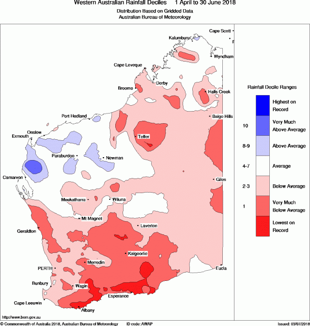
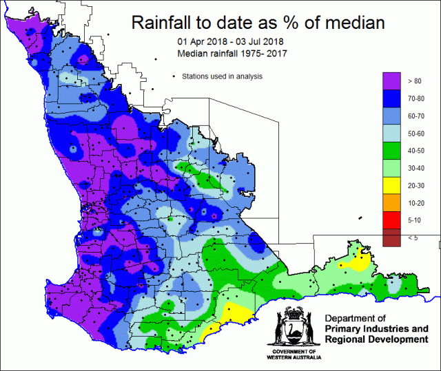
Seasonal rainfall deciles (April to June) show a very dry the start to the growing season (Figure 4). Good rain in early July has advanced much of the northern grainbelt to be close to median rain to date (Figure 5). South-eastern parts of the grainbelt remain well below seasonal median rain to date.
Soil moisture
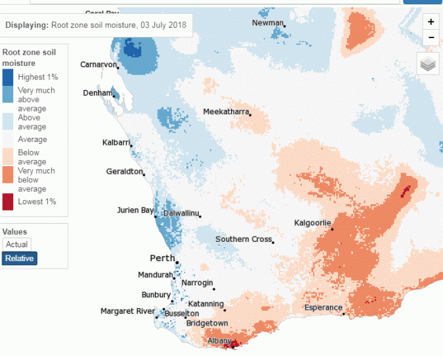
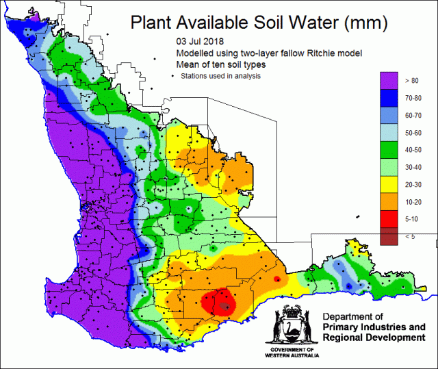
Soil water storage has improved over northern and western parts of the grainbelt, as expected from the rainfall pattern in the past week. Figure 6 shows the estimated root zone soil water storage from the Bureau of Meteorology landscape model, as relative storage for the time of the year. Low levels of soil water remain in the eastern and south-eastern grainbelt.
Figure 7 shows the estimated fallow soil water storage to 3 July 2018 from the DPIRD soil model. Rain since 27 June has been mostly less than 10mm, so north-eastern and southern parts of the grainbelt have low levels of soil water storage.
Rainfall forecast for the next week
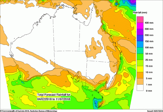
Rainfall forecast for the week ending 11 July 2018 is likely to be lighter than for the start of the month. Although rain will occur over the grainbelt, totals appear to be less than 10mm (Figure 8).
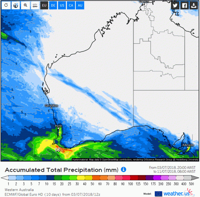
The ECMWF model is predicting a similar spatial pattern of rainfall over the coming week. Total predicted rainfall from the ECMWF model for the next 10 days is shown in Figure 9.
