Rainfall update 7 August 2018
Rainfall for the month to date
Rainfall has continued the first week of August, with good falls along the west coast and northern grainbelt, as well as the south-west and coastal parts around Esperance (Figure 1).
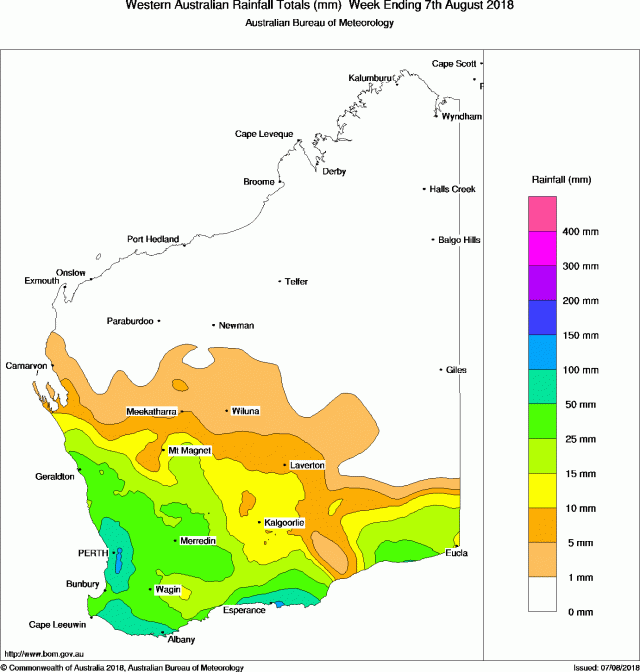
Monthly rainfall to date is available from the DPIRD weather stations and radar page (select Month to Date from the drop-down menu).
Seasonal rainfall
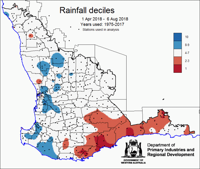
Good rain in July and the first part of August has advanced much of the northern and central grainbelt to be close to or above median seasonal rain to date (Figure 2). South-eastern parts of the grainbelt remain well below normal seasonal rain to date, with much of the south coast at decile 2. Note Figure 2 uses the years 1975-2017 as reference period for derivation of deciles. This period is drier than the baseline used by the Bureau of Meteorology (1961-1990).
For graphs of rainfall at individual locations, see DPIRD’s Rainfall to date tool.
Soil moisture
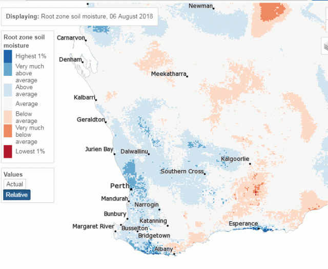
Figure 3 shows relative root zone soil water storage to 6 August 2018 from the Bureau of Meteorology’s Landscape Water Balance model. Rain in early August has improved soil water storage for much of the grainbelt and parts of the south coast. A region along the south coast east of Albany remains with relatively low levels of soil water storage for this time of year.
For soil water estimates at individual locations with and without crop water use, see DPIRD’s Soil water tool.
Potential yield
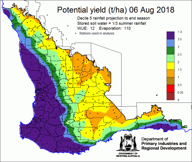
Potential crop yield is estimated using the French-Schultz relation, and uses seasonal rainfall from 1 April to date. Rainfall for the rest of the growing season (to 30 September) is assumed to be decile 5. This model does not account for crop diseases or soil constraints.
To estimate yields at individual locations refer to the Potential yield tool.
Rainfall forecast for the next two weeks
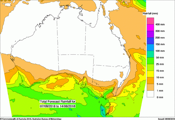
Rainfall forecast for the next week shows continuing rain for the west coast and south west of WA (Figure 5). Smaller totals are forecast for the south coast, as has been the persistent pattern this year.
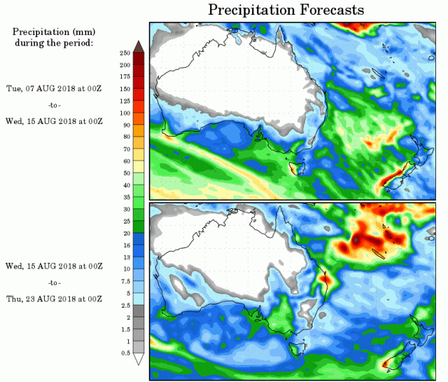
Beyond next week, the US NCEP model indicates lighter falls for the middle of the month (Figure 6).
