Identifying groundwater resources
The West Midlands project was undertaken in three stages:
- airborne electromagnetic (AEM) geophysical survey
- drilling program to install a system of monitoring bores and a production bore
- aquifer test pumping to determine aquifer parameters.
Airborne electromagnetic survey
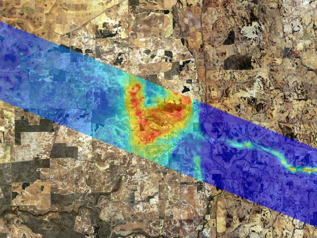
The AEM survey covered a rectangular area about 50 km long by 7 km wide, extending from New Norcia in the east to Yathroo in the west (see image below).
The survey was flown in October 2012 to acquire data which is used to build a picture of electrical conductivity in the profile which is then interpreted to understand the geology.

The recently discovered palaeochannel (thin blue wavy line) shows up clearly in the east of the survey area because it contains more conductive material than the surrounding granitic rock which has zero conductivity. Where the palaeochannel crosses the Darling Fault, which roughly aligns north-south along the Bindoon-Moora Road, and enters the Perth Basin (west of the road), the conductivity of the palaeochannel sediments is similar to the conductivity of sediments in the Perth Basin. It is presumed the palaeochannel continues westward, although it is possible the palaeochannel sediments in the west are not linked to the palaeochannel in the east.
Drilling program
Over the 2013–14 summer, 16 x 50 millimetre (mm) diameter groundwater monitoring bores were installed at eight sites near the palaeochannel.
One larger (200 mm diameter) bore, known as a ‘production bore’, was installed in the middle of the palaeochannel to use as an aquifer test pumping site.
The easternmost monitoring site was 6km north-west of New Norcia. At this site the palaeochannel sediments extended to 197 metres (m) deep, which was an astonishing and unexpected depth. Other deep palaeochannels found in the agriculatural region have achieved no more than 90–100 m depths and are more typically only 40–50 m deep.
Further to the west where the palaeochannel crossed the Gillingarra-Glentromie Road, the palaeochannel sediments extend to a depth of 192 m.
Aquifer testing
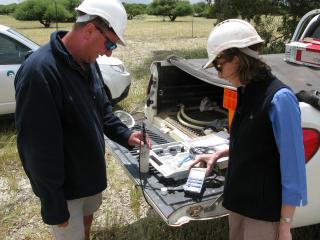
An aquifer testing program to assess the sustainable yield and water quality available from the production bore was completed in March 2014. The pump was installed at 40 m depth and set to discharge water at varying rates until a constant 8 litres per second rate was achieved. The bore recovered very quickly, better than 90% recovery within 5 minutes. The water level in the production bore was drawn down 32 m and stayed constant at that level. Water quality testing revealed an electrical conductivity of 300 millisiemens per metre or less than 1700 milligrams per litre.


