How to use this survey
This survey can help pastoral industry managers to plan and manage for sustainable use of pastoral natural resources, and protect degraded areas or areas at risk of degradation.
This survey:
- identified and described the condition of soils, landforms, vegetation, habitat, ecosystems, and declared plants and animals
- assessed the impact of pastoralism
- recommended land management, including recommended carrying capacities, for each pastoral lease.
Survey area and inventory summary
The Western Australian part of the Nullarbor region was surveyed between 2005 and 2007 by PA Waddell, AK Gardner and P Hennig. The department published this survey in 2010 as Technical bulletin no. 97 An inventory and condition survey of the Western Australian part of the Nullarbor region.
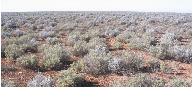
The Nullarbor region has unique, extensive, gently undulating stony plains of limestone karst that form the Bunda Plateau. As well as vast treeless plains through the region's centre, the Bunda Plateau is Australia’s largest karst and the world’s largest arid karst region (about 250 000 square kilometres).
An area of about 118 358 square kilometres was covered in the Nullarbor survey. The northern survey limits were defined by pastoral lease boundaries and the southern limits were bounded by the Southern Ocean. The western limits of the survey area were defined by the western-most Nullarbor pastoral lease boundaries and the eastern limit was defined by the Western Australia – South Australia border.
Pastoralism was the most extensive land use. Twenty pastoral leases fell wholly within the survey area and collectively occupied about 57 673 square kilometres (49% of the area). Areas set aside for nature conservation at the time of survey covered about 9526 square kilometres (8% of the area), consisting of the Eucla National Park, the Great Victoria Desert and the Nuytsland Nature Reserves, and some smaller parcels of land.
Eighteen soil groups were identified within the survey area. The most common soil group was calcareous shallow loams, occurring on all but coastal and subcoastal land systems. In comparison with other biogeographic regions in Western Australia, the flora of the Nullarbor region was not particularly diverse, with 426 vascular species recorded during the survey. Of these species, 383 were native. Eight of the 15 plant species on the Declared Rare and Priority Flora listing for the survey area were collected during the survey.
Condition summary
The survey report provides condition statements – for the time of the survey – for the whole survey area and for each land system. Pasture and soil condition was assessed at more than 12 000 points throughout the survey area. The survey found that:
- 66% of these points were in good rangeland condition
- 26% were in fair rangeland condition
- 8% were in poor rangeland condition.


