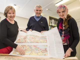
Almost 400 technical reports on land and water resources throughout the State are now available online thanks to work being completed by the Department of Agriculture and Food.
The resource management technical reports, dating as far back as 1974, have been added to the department’s electronic Research library, along with soil and land condition maps which date back to the mid-1900s.
They cover a range of topics including natural resource spatial information, salinity, regional water quality, land capability assessments, soil quality and water management plans.
Department Land and Water Assessment director Melanie Strawbridge said the department’s Land and Water Assessment Branch had been prolific at creating information and reports which were important to the wider community.
“Thanks to months of work by department staff, these reports are now easily accessible online,” Dr Strawbridge said.
Department research officer Dennis Van Gool said the information being captured in the research library was a valuable snap shot at different points in time.
“There’s a perception that a lot of old information is dated, however aside from the fact that soils usually change very slowly, historic soil, vegetation and water data is an extremely valuable record,” Mr Van Gool said.
“This information helps build a picture of the amount and the rates of change over time. For example, our corporate soils databases used for mapping and modelling productive agricultural land, are built up using historic and current information.”
Mr Van Gool said the team was currently sorting through some maps with basic soil and land condition information dating back to the early 1900s and mid-1900s.
“This is a work in progress, but at the moment, we have scanned and uploaded about 100 high resolution soil maps to the Research library,” he said.
“These include maps associated with department reports, such as the land resources series, pastoral surveys as well as a few historical CSIRO maps.
“There is a viewing tool that allows users to view the details, and maps can also be downloaded.”
To view the reports and images, visit the department’s Research library, or via the department website, search for ‘research library’.

Media contacts: Jodie Thomson/Lisa Bertram, media liaison 61 (0)8 9368 3937
