Why we carried out this investigation
This investigation is part of a broader package of work on the capacity for new groundwater resources to be used to grow irrigated agriculture in Western Australia.
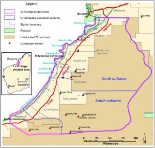
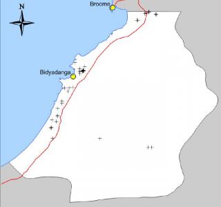
Using groundwater for irrigated agriculture could affect watertables that underlie wetlands in the La Grange area (Figure 1).
We carried out this investigation and production of a watertable model to identify groundwater dependent wetlands that could be affected by irrigation. This information can then be used to plan for sustainable resource use and to avoid damaging off-site impacts from irrigation.
What we did
We created a watertable-surface model to identify wetlands and determine which of the previously mapped wetlands are likely to use water from the Broome Sandstone aquifer.
We used 148 points taken from bore data to create the watertable-surface model. We then validated the accuracy of the modelled watertable surface with drilling data.
You can view results from the model through the interactive groundwater map.
What we found
The results of the drilling show a strong correlation with the modelled surface, which in turn was able to identify 43 groundwater dependent wetlands (some of which were previously unmapped) (Figure 2) and validate 85 previously mapped wetlands as being groundwater dependent.
What this means
The watertable-surface app and map of wetlands meets the needs of several groups:
- Irrigators and water managers can use the multiple maps and web tools to estimate the depth to the watertable, saturated aquifer thickness and unsaturated areas within the La Grange groundwater area.
- Government and researchers can use the watertable-surface app as an integral part of scenario modelling of the aquifer. Scenario modelling allows us to test a range of impacts on the aquifer and its wetlands from the further development of irrigated agriculture.
- Irrigators and other land managers can use the wetlands map to identify and develop management plans to minimise environmental risks.
Acknowledgements
We carried out this investigation as part of the Regional Economic Development Water Opportunities Project, which aims to promote agribusiness through the development of land and water resources in the Kimberley.
This investigation was made possible by Royalties for Regions investment by the Western Australian Government.
For more information
Download Identifying groundwater-dependent wetlands of the Broome Sandstone aquifer in the La Grange groundwater area, Western Australia, Resource management technical report 397.
Visit the La Grange Western Australia groundwater interactive map page.

