Report overview
The Planning for the proposed Peel Food Zone Report was prepared by GHD in collaboration with the department, and assessed the feasibility of six agricultural land use scenarios in the Peel Food Zone investigation area including:
- Dryland pastures for grazing (current use)
- Irrigated annual horticulture such as leafy vegetables
- Irrigated perennial horticulture such as fruit trees and grape vines
- Covered irrigated horticulture such as strawberries in tunnel houses
- Closed-system horticulture including glasshouses with hydroponics
- Closed-system intensive animal production such as cattle feedlots, shedded poultry and piggeries.
The suitability of each agricultural land use scenario was analysed by GHD using environmental, social, infrastructure and physical data sets for the region. Spatial software was then used to generate a series of maps to show where each land use scenario was most suited.
The study found the eastern Peel Food Zone investigation area is suitable for a wide range of agriculture, however western areas are better suited to closed production such as hydroponics. Some land in the Peel Food Zone investigation area is constrained to such an extent that it is unsuitable for agricultural development.
Future agricultural activities within the area will be guided by the opportunities offered by the Peel's road, power and digital networks as well as its land capability and water availability.
Challenges presented by the environmental importance of the Peel-Harvey estuary and wetland systems and the need to separate intensive farming from sensitive urban and rural residential areas must also be considered. Transformation of agriculture in the Peel requires changes to established farming practices, alternative ways of managing soil and water and new or different types of farms and production systems.
A summary of the key findings from the report is presented here. The full report - available in Parts A, B, C and supporting appendices, including land suitability maps - is available to download on the right hand side of this page.
Availability of water for agricultural scenarios
The GHD investigations used simplified information and made assumptions about the availability for water for the different agricultural development scenarios.
The Department of Water and Environmental Regulation's Peel Integrated Water Initative implemented an extensive technical program which assessed the water opportunities and constraints related to the economic development objectives of the Transform Peel program.
The technical studies of water resources, including impact sof climate change, focussed on the Peel Food Zone investigation area. Findings from the Peel Integrated Water Initative studies were not released until after GHD's investigations.
Location of the Peel Food Zone investigation area
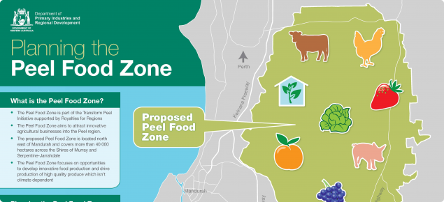
Under the Transform Peel program, the Peel Food Zone investigation area initially covered about 28 000 hectares and was located ten kilometres (km) east of Mandurah and about 70km south of Perth. This area was chosen for its agricultural production potential, proximity to population centres to supply the anticipated workforce and access to infrastructure for logistics and communication purposes.
During the consultation process for the GHD study, the Peel Food Zone investigation area was extended:
- East to include the high quality, more fertile soils along the foot slopes of the Darling Range
- North to include established agriculture and food enterprises including poultry farms.
The southern and western boundaries were also revised on advice from stakeholders including local governments.
The change to the boundary increased to total investigation area by 50% to 42 000ha in the Shires of Murray and Serpentine-Jarrahdale.
The majority of the Peel region's population live in Mandurah, west of the Peel Food Zone investigation area. The town of Pinjarra is the region’s next most populous centre and is located southeast of the investigation area. The township of Serpentine is located in the northeast and North Dandalup in the southeast of the investigation area.
Existing land uses and enterprise types
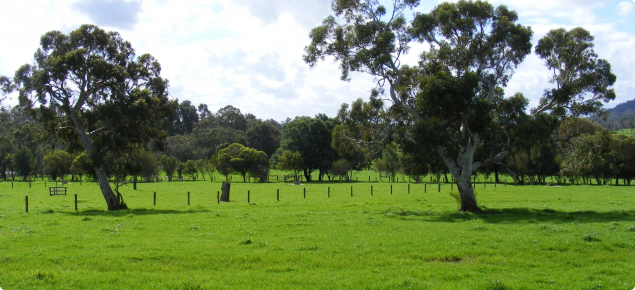
The current use of the Peel Food Zone investigation area is mainly rural land used for grazing with pockets of residential, rural living and rural residential development.
Livestock (cattle) production and hay cropping dominate the area, with smaller areas of intensive agriculture relating to animal production (piggery and poultry operations), turf and fruit trees, and a number of equestrian studs and agistment facilities.
Mining for mineral sands is an important land use in the region with approximately two per cent of the Peel Food Zone investigation area registered for this land use.
Future roll out of the planned Peel Business Park will see about 1000ha of the largely grazing land transition to industrial uses including agrifood processing.
Dryland pastures and grazing
Beef cattle grazing as well as horses, dairy cattle and sheep grazing modified pastures occupy about 72 per cent of the Peel Food Zone investigation area. Hay and other fodder production from dryland (non-irrigated) pasture is also included in this suitability assessment.
The most suitable grazing land were identified along the eastern edge and centre in the southern half of the investigation area. These areas have relatively fertile soils which retain phosphorus and are located away from sensitive waterways and wetlands.
In the western areas, a major constraint to grazing is the high risk of phosphorous export when fertilisers are applied to deep sandy soils close to sensitive waterways and wetlands.
Careful fertiliser use is needed to protect nearby Peel-Harvey waterways and estuary. For this reason, farmers in the Peel-Harvey are encouraged to test their soils for nutrients and only apply the type and amount of fertilisers needed for pasture growth. The addition of clay and soil amendments to increase the retention of phosphorus are options being explored in the Peel-Harvey.
Click here to access the Dryland pastures and grazing suitability maps.
Irrigated annual horticulture such as leafy vegetables
Annual horticultural crops, such as turf production and leafy vegetables, currently occupy less than one per cent of the Peel Food Zone investigation area.
This land use scenario involves the commercial production of annual plants with short-term life cycles (typically completed within the period of a year) which are irrigated in open (uncovered) paddocks. The GHD analysis considered a broad range of crops including annual fruits (strawberries, melons, etc.), vegetables (e.g. potatoes, lettuce, cabbages, tomatoes, pumpkins, etc.), commercial turf production and cut flowers. It also includes irrigated pastures used for grazing.
Suitable land for annual horticulture were mapped in the east of the investigation area, flanking the South West Highway. Development in some areas is restricted by the need to separate new horticulture farms from rural lifestyle properties and urban areas (existing and planned areas).
Development of annual horticulture is highly constrained by the soils of the Peel Food Zone investigation area which have high risk of phosphorus export and in areas with limited water for irrigation along the edge of the Darling Scarp.
Existing and planned rural residential development restricts suitable areas for commercial horticulture in the southern investigation area.
Click here to access the Irrigated annual horticulture suitability maps.
Irrigated perennial horticulture such as fruit trees and grape vines
Perennial horticultural crops,such as avocados and wine grapes, occupy less than one per cent of the Peel Food Zone investigation area.
This land use scenario involves growing commercial crops of long life-cycles (typically trees, shrubs or woody vines) using irrigation in open (uncovered) paddocks. the analysis includes orchard crops (e.g. apples, citrus, stone fruit, avocados, nuts, etc.) and vineyard crops (e.g. grapes and kiwifruit). Although the plants are perennial, crops are harvested annually.
In general, land assessed as suitable for perennial horticulture uses is similar to areas most suitable for annual horticulture. Some differences arise on the slopes as perennial crops can grow on steeper land than annual crops although perennials require deeper soils than annuals, due to their deeper root systems. Suitable areas for perennial cropping are in the east, flanking the South West Highway. In the southern investigation area, new areas of commercial scale perennial crops would need to be separated from rural lifestyle areas, where commercial cropping is not permitted.
Additional development of perennial horticulture is restricted by soils with a high risk of phosphorus export, limited water for irrigation along foot slopes of the Darling Scarp and areas of existing and planned rural residential development.
Click here to access the Irrigated perennial horticulture suitability map.
Covered irrigated horticulture such as strawberries in tunnel houses
Covered or protected cropping for horticultural food crops is an emerging system in Western Australia but is well established in the commercial nursery industry. This land use scenario involves covering irrigated horticultural crops which are grown in soil in order to manage the impact of natural elements particularly temperature, rainfall and wind.
By using waterproof plastic tunnel houses or other types of covers to intercept the winter rainfall, the levels of soil nutrients washing into the water table and draining off the paddocks is reduced, allowing crops to be grown closer to sensitive waterways and wetlands.
Covering horticultural crops also reduces the risk of spray drift from cropped areas onto residences and increases water use efficiency. These assumptions decreased the relative adverse impact of covered cropping on receiving water bodies and on residences and increased the area of suitable land for this land use scenario.
The use of covered horticulture does not mitigate inherent features of the Peel Food Zone investigation area such as land capability, the risk of phosphorus export and the availability of groundwater which were assessed the same as for irrigated annual annual horticulture.
Click here to access the covered irrigated horticulture suitability maps.
Closed-system horticulture including glasshouses with hydroponics
Closed-system horticulture is a sub-set of protected agriculture. In GHD's suitability assessment, this land use scenario assumed engineered, glasshouse/enclosed production systems that featured water re-use, temperature and nutrient control. Most importantly it was assumed that no nutrients were exported into the natural environment and that waste was disposed of in closed-loop systems.
Most of the Peel Food Zone investigation area is suited to closed-loop horticulture with highly suitable areas located close to existing infrastructure, specifically Restricted Access Vehicle (RAV4) networks, three-phase power and Internet networks. The analysis concluded that the central corridor of thePeel Food Zone investigation area is highly suitable for this system reflecting the established RAV4 network.
By definition, using closed-loop systems assumes that neither water nor nutrients are exported from the site and therefore the risk of phosphorus export was not included as a criterion. Access to irrigation water remains important, meaning this system is less suited to the eastern edge of the investigation area, where groundwater is very limited.
Proximity to residences in urban and rural-residential areas constrains where this system can be located. While spray drift is less of a concern, glass house production may be associated with potential amenity impacts caused by increased traffic, noise and light. Visual impact may also be an issue and will need to be considered in planning.
Click here to access the closed-system horticulture suitability maps.
Closed-system intensive animal production such as cattle feedlots, shedded poultry and piggeries
The closed-system intensive animal production scenario includes cattle feedlots, shedded poultry and piggeries. It is assumed facilities are well designed and use engineered structures (sheds, hard stand) to house livestock and to control and manage waste so it doesn't enter the environment.
Opportunities are offered by established infrastructure, specifically the Restricted Access Vehicle (RAV4) and three-phase power line networks in the central and northern section of the proposed Peel Food Zone.
Depth to maximum groundwater level is a key criteria for intensive livestock enterprises which need to be located on land with water tables greater than two metres from the surface throughout the year.
Data from a maximum groundwater depth model, provided by the then Department of Water and Environmental Regulation, was used in the GHD analysis. Initially most of the Peel Food Zone investigation area was mapped as unsuitable for intensive livestock due to the large areas of low lying land which is frequently waterlogged during winter.
Landfill is commonly used on the coastal plain to raise the land surface, improve site drainage and increase the separation to shallow water tables. It was therefore assumed that where average water table depth was between 0.5m and 2m, landfill could be used to increase the separation to the shallow water table, meaning these areas were constrained, and more costly to develop, but not unsuitable. Including this assumption, increases the proportion of Peel Food Zone investigation area which may be suitable for closed-loop intensive livestock production.
Another major constraint to closed-loop intensive livestock production is the need to maintain a large buffer to existing and planned rural living areas. Such areas are common on the the southern half of the Peel Food Zone investigation area and resulting in significant areas being assessed as unsuitable for intensive livestock production.
Click here to access the closed-system intensive animal production suitability map.
Overall suitability for agriculture
GHD found that four factors were most influential in determining suitable areas in the Peel Food Zone investigation area for agricultural development:
- Urban and rural residential zoning
- Environmental assets
- Land capability and phosphorus export risk
- Infrastructure.
Water is critical for development and its importance is recognised under the Transform Peel initiative's Peel Integrated Water Initative, managed by the Department of Water and Environmental Regulation. These studies have not been incorporated in the land suitability assessments.
The population centres and rural living zones are generally concentrated in the southern and northern sections of the Peel Food Zone investigation area. These areas require adequate separation distances (buffers) between intensive agricultural activities where adverse impacts from spray drift, light and noise emissions may occur.
The natural environments of the Peel region are widely regarded as valuable assets to be protected and enhanced. The environmental assets in the Peel Food Zone investigation area, including the Peel-Yalgorup System Ramsar site, other major waterways and native remnant vegetation, were assessed as not suitable for agricultural development.
Land capability and the risk of phosphorus export were important factors in assessing the suitability of all soil based land use scenarios with more inherently fertile soils located in the eastern and southern parts of the Peel Food Zone investigation area.
Access to infrastructure including roads, power and telecommunications are important for intensive livestock and horticulture scenarios which rely on regular transport of product in and out of facilities, reliable power supplies for lighting and pumps and efficient telecommunications for monitoring, quality assurance and marketing.
In summary, soil based agricultural land use scenarios are better suited to land in the eastern sections of the Peel Food Zone investigation area, reflecting its higher land capability and lower risk of phosphorus export however along the eastern boundary, groundwater supplies are constrained.
Closed-loop agricultural systems are best suited to land close to established infrastructure, particularly the restricted access vehicle (RAV4) road network and three-phase power. These land use systems, assume that production requirements such as nutrients, water, light, temperature and pest control for both plants and animals, will be provided and not reliant on seasonal conditions.
Caveats to using the suitability mapping
- The data sets used by GHD in this study have been used at a ‘gross’ scale and therefore provide indicative findings as to the suitability of each land use scenario within the Peel Food Zone investigation area.
- Potential investors looking to establish food-producing industries will be required to gain development approval.
- Due diligence will be required to confirm access to water, the site suitable for food production, i.e. not contaminated, and there are no caveats on the land for environmental and heritage purposes.
- Regulators and the Peel community will expect that environmental conditions and standards will be maintained.
- New agricultural developments may be encouraged to invest in improving the environmental health through re-vegetation, nutrient management and monitoring practices and water quality management.
- Opportunities may arise from interventions in the landscape, which alter land capability such as mining operations and the widespread use of soil amendments. These interventions may reduce the impact of constraints associated with nutrient retention and water availability.


