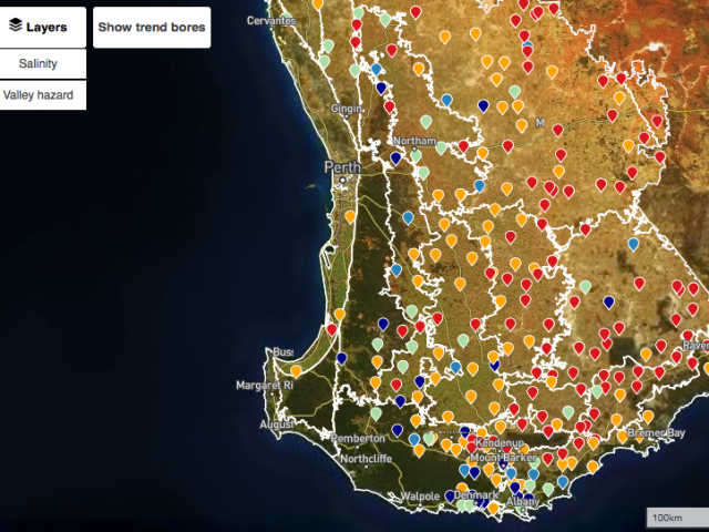
New groundwater and salinity map launched

The Department of Primary Industries and Regional Development has taken a bold step forward, presenting 30 years of valuable groundwater research and monitoring data in an interactive map, allowing users to examine trends in their own area.
The Interactive groundwater and salinity map targets the south western half of the state and allows exploration of regional and local groundwater trends, the mapped extent of dryland salinity and areas with potential for increased dryland salinity.
This information supplements the valuable land capability information available on the NRInfo interactive website.
The map also provides an estimate of salt levels in the groundwater, together with likely presence and risk of salinity based on satellite imagery and landscape position.
Trend-bores on the map show where water tables are rising, stable or falling, and with all of this information, landholders will be able to adapt their land management to suit the conditions.
For example, with rising groundwater levels and a risk of salinity, consideration can be given to early engineering or alternate plant varieties.
If considering a dam to drought-proof your property, you can check bore information and the risk of salt developing to choose the safest site(s).
Zoom in and look at your local bores. You will need to do local and current measurements before going ahead, but the map will help identify areas of concern.
With this information now being made publicly available, other parties with an interest have the opportunity to value-add.
Advisors can use this information when discussing management options with you, and industry will be able to find innovative ways to make use of the data.
This platform provides opportunity for additional information to be added as it becomes available.
For more information contact Nicholas Wright, Research Officer, Bunbury, on +61(8) 9780 6286.
