Summary
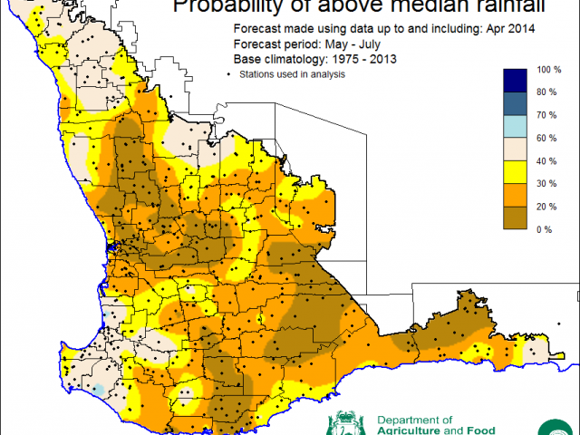
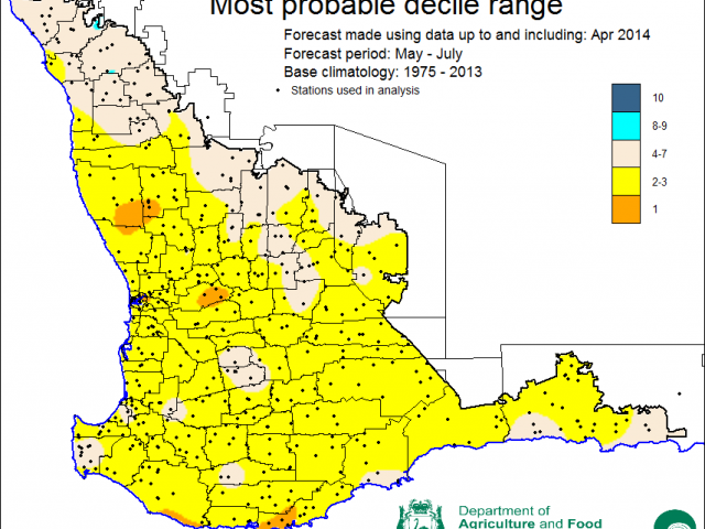
The Department of Agriculture and Food, Western Australia’s (DAFWA) Statistical Seasonal Forecast (SSF) system indicates a drier than normal rainfall outlook for most of the south-west of WA for the next three months, May to July 2014.
- Predictive skill is medium to good based on April conditions.
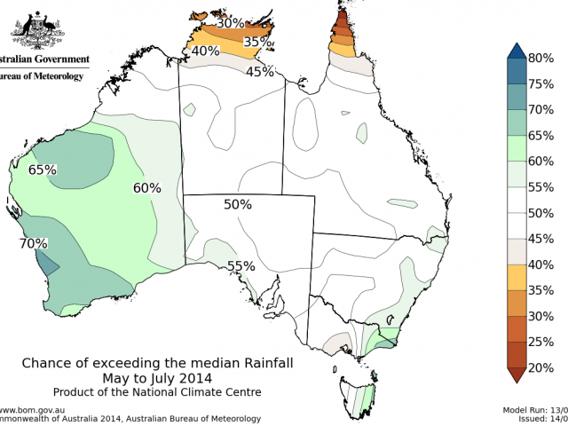
- The Bureau of Meteorology (BoM) seasonal outlook indicates normal to wetter than normal rainfall for the south-west of WA over the next three months. Predictive skill is medium to good. Temperature outlooks are indicating normal to warmer than normal maximum temperatures and warmer than normal minimum temperatures.
- Rainfall in the past month was normal or below normal for the wheatbelt, except for parts of the eastern wheatbelt that received above normal rainfall. Maximum temperatures were warmer than normal and minimum temperatures were close to normal.
-
An El Niño event is likely to occur this winter but it’s effect is likely to be minimal in the south west of WA if the Indian Ocean Dipole remains neutral.
Three month outlook for the south-west of Western Australia
Statistical Seasonal Forecasting (SSF)
DAFWA’s Statistical Seasonal Forecast (SSF) system uses historical relationships between global sea surface temperature and sea level pressure with rainfall in south-west Australia to produce forecasts of rainfall for the coming months.
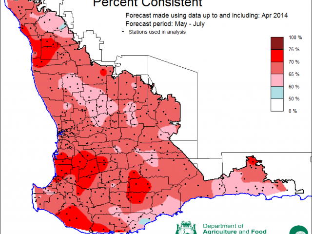
The SSF forecast for the next three months, May to July 2014, has a drier than normal rainfall outlook for most of the south-west of WA (SWWA) with decile 2-3 rainfall most probable for all areas excepting the Northern and parts of the eastern wheatbelt where normal conditions are more likely. Predictive skill is medium to good based on April data.
Bureau of Meteorology seasonal climate outlook
The Bureau of Meteorology (BoM) has a new operational seasonal climate forecasting system based on the POAMA2 model, a dynamical model that simulates interactions between oceans and the atmosphere.
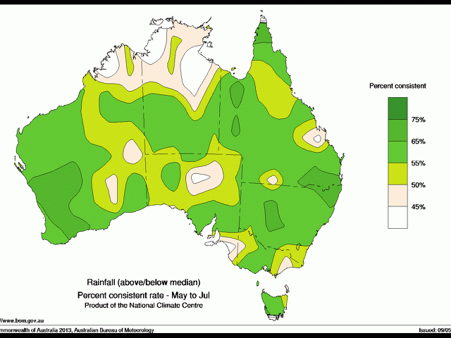
The model has a wetter than normal outlook for rainfall over the south-west of WA for the next three months. The outlook has medium skill for the south-west.
Temperature outlooks are indicating normal to warmer than normal maximum temperatures and warmer than normal minimum temperatures.
Recent climate
Rainfall in April was normal or below normal when compared to the 30-year reference period 1961-1990 published by the Bureau of Meteorology, except for parts of the eastern wheatbelt that received above normal rainfall. Maximum temperatures were warmer than normal and minimum temperatures were close to normal.
Sea surface temperature (SST) in the central Indian Ocean remains warmer than normal. SSTs around Indonesia are also warmer than normal; however, the Indian Ocean Dipole remains neutral.
Atmospheric pressure over south-west Australia was average to slightly lower than average in April.
The table below summarises a selection of Australian climate indicators for the past month and past three months. The status comments refer to deviations from average conditions (eg. wetter than average).
| Climate Indicator | Past month | Past 3 month |
|---|---|---|
| Drier | Drier | |
| Warmer | Warmer | |
| Average | Above average | |
| Warmer Indian Ocean | Warmer Indian Ocean | |
| El Nino/Southern Oscillation (ENSO) | Neutral | Neutral |
| Indian Ocean Dipole (IOD) | Neutral | Neutral |
| Southern Annular Mode (SAM) | Positive | Varying |
BoM forecasts of ENSO indicate a greater than 70% chance that an El Niño event will develop this winter. Climate models surveyed by the Bureau of Meteorology also suggest that an El Niño is likely.
For a summary of Pacific and Indian Ocean outlooks, see the Climate Model Summary produced by BoM.
The IOD is currently neutral and expected to remain neutral over the coming months. While a combined El Niño event in the Pacific Ocean and a positive IOD event in the Indian Ocean is related to drier conditions in SWWA, and El Niño occurring without a positive IOD is unlikely to have much impact on SWWA rainfall. Current model outlooks suggest that neutral IOD conditions will continue in late autumn into early winter, with two out of five models suggesting that a positive IOD may develop by early spring.
Growing season outlook for the south-west of Western Australia
The May to October outlook from the SSF indicates normal to drier than normal (decile 2-3) conditions for most of the wheatbelt, except the Northern Agricultural Region. The forecast accuracy is medium to good at this time of year.
Additional information for WA wheatbelt
- Pestfax Map
- AgTactics eNewsletters:
Northern Agricultural Region
Central Agricultural Region
Southern Agricultural Region
Esperance Region

