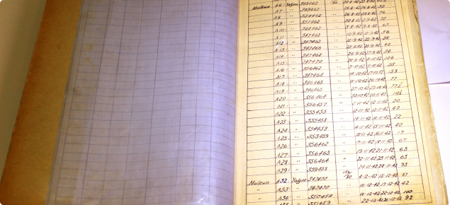
Project Overview:
Wide ranging hard copy hydrogeological information from priority irrigation areas has been digitally captured and made available online to private sector investors and growers, vastly reducing the need for expensive water investigations in areas where comprehensive data already exists.
More than 70 years worth of bore data has been digitised and published as part of the Water for Food initiative. Five thousand handwritten and typed records that have been stored away in archives, now digitised and published online for the first time. More than $50 million worth of historic water bore data was released over three years to fast-track the development of water resources for food production projects worth hundreds of millions of dollars.
The records provide hydrogeological data from 50 000 water bores that have been drilled across WA since the 1940s, including their location, construction, lithology, pump test results and field sample information.
There has been a significant increase in access to the data, and an associated reduction in turnaround time for water information. This demonstrates the demand for the information which provides base data for water resource investigations and assessments that underpin secure water supplies for future developments and economic growth.
The information is now accessible through the Department of Water and Environmental Regulation's Water Information Reporting portal.
Benefits of having extensive water information available include:
- Streamlining processes and fewer delays collecting data
- Less invasive on the land, with a reduced need to drill new bores
- Reduction in lengthy monitoring periods and analysis
- Reduction in development costs
- Better planning for the design of road, rail and pipeline infrastructure

